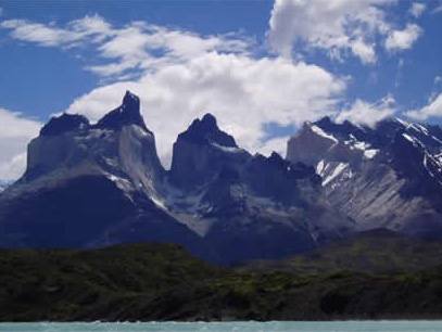
Strait of Magellan and Punta Arenas

Chilean Antarctic Territory

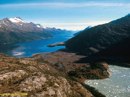
Cape de Hornos and Canal Beagle

The Chilean Antarctic Province is the largest in Chile, since it includes the Navarino Island, the Antarctic Territory and the National Parks Alberto de Agostini and Cabo de Hornos. In total, the territory of this province has 1,250,000 km². It is located in the South Pole and its capital is Puerto Williams, on Navarino Island.
The Antarctic Continent, and the bases installed there, are natural reserves dedicated to peace and scientific research. For this reason, any activity that takes place on the white continent, including tourism, is regulated to maintain its cleanliness and decontamination. The 45 countries that make up the Antarctic Treaty ensure that the regulations are complied with. Chile is one of them. The Treaty is an agreement between 45 countries, signed in 1959 by twelve nations. It states that Antarctica should be used for peaceful and scientific purposes, activities planned and informed in advance to avoid conflicts.
The Antarctic Continent, and the bases installed there, are natural reserves dedicated to peace and scientific research. For this reason, any activity that takes place on the white continent, including tourism, is regulated to maintain its cleanliness and decontamination. The 45 countries that make up the Antarctic Treaty ensure that the regulations are complied with. Chile is one of them. The Treaty is an agreement between 45 countries, signed in 1959 by twelve nations. It states that Antarctica should be used for peaceful and scientific purposes, activities planned and informed in advance to avoid conflicts.
The ecosystem of the Antarctic continent is fragile, that's why special care must be taken when receiving tourists and installing settlements. All of them must respect the more than 150 recommendations specified by the Antarctic Treaty.
Antarctica is an isolated continent, far from the rest of the civilization of South America, the closest to the white continent and even a thousand kilometers away. Despite its remoteness, tourism has increased considerably in the last decade, receiving people from all over the world, who seek to know a continent completely different from the others. Access is possible only in summer, since the rest of the year the 'road' is covered with ice, which makes it impossible to reach Antarctic territory.
Antarctica is an isolated continent, far from the rest of the civilization of South America, the closest to the white continent and even a thousand kilometers away. Despite its remoteness, tourism has increased considerably in the last decade, receiving people from all over the world, who seek to know a continent completely different from the others. Access is possible only in summer, since the rest of the year the 'road' is covered with ice, which makes it impossible to reach Antarctic territory.
Attractions
The city of Punta Arenas offers an immediate attraction, since it is the most modern city on that side of the world. The Magallanes-Punta Arenas area is also located on the coast of the Strait of Magellan, along which you can find National Reserves (Laguna Parrillar and Magallanes), the Pali Aike National Park and the cavern of the same name, rivers , hills, Fuerte Bulnes and Laguna Blanca, among others.
Activities
The last place in the world offers a wide range of activities to practice. These include photography, observation of flora and fauna, sea kayaking or sailing, recreational fishing, horseback riding, walking, recreational diving, buggy, canoeing, recreational hunting, cycling, free climbing, mountain skiing, mountain biking, sailing Recreational, sailing, rowing, picnic, hiking, swimming.
Informacion de Interes
1When to go
Throughout the year.
2Location
Region of Magallanes, 3,090 kms., From Santiago, the capital of Chile.
3How to get
Punta Arenas is reached by plane or by land. There are direct flights that leave every day from Santiago. By land there are two options, either by Chile or by Argentina, using one of the two border crossings available: Monte Aymond in Magallanes and San Sebastián in Tierra del Fuego. Through Chile, the CH 255 route that connects Mount Aymond with Punta Arenas and borders the Strait of Magellan is used.
4Weather
Temperate cold and rainy, sunnier in summer. Temperatures between 4 C and 15.3 C.
5Services
Accommodation, travel agencies, coffee, coffee, restaurant, hotel, residential, interurban transport, entertainment (bars, discos, diving, etc.), cruises, ferry, airport, car rental, taxis, buses.
6Surroundings
Strait of Magellan, Porvenir, Magallanes Forest Reserve, Laguna Parrillar Forest Reserve, Otway Sound, Los Pingüinos Natural Monument, Dawson Island.
7Input Value
Free
Destinations
Cabo Froward
Cerro de la Cruz
Cerro MIrador
Cueva Mirador
Cueva Pali-Aike
Strait of Magellan
Fort Bulnes
Laguna Blanca
Los Pinguinos Natural Monument
Pali Aike National Park
Punta Arenas
Punta Dungenes
Laguna Parrillar National Reserve
Magallanes National Reserve
Perez River
Green River
Seno Otway


